

Claus Scheiblauer, Michael Wimmer
Graph-based Guidance in Huge Point Clouds
In Proceedings of the 17th International Conference on Cultural Heritage and New Technologies. November 2012.
[ paper] [
![]() slides]
slides]
Information
- Publication Type: Conference Paper
- Workgroup(s)/Project(s):
- Date: November 2012
- ISBN: 978-3-200-03281-1
- Location: Vienna, Austria
- Lecturer: Claus Scheiblauer
- Booktitle: Proceedings of the 17th International Conference on Cultural Heritage and New Technologies
- Conference date: 5. November 2012 – 7. November 2012
- Keywords: user interface, navigation, point rendering
Abstract
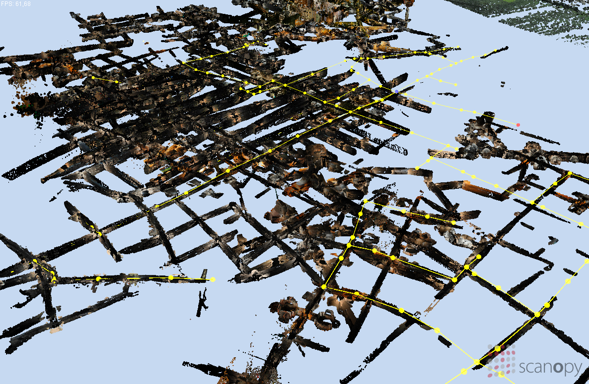
In recent years the use of remote sensing devices like laser scanners in the documentation of excavation sites or cultural heritage sites has led to huge point cloud models from these sites. These data sets may cover complete sites including galleries, corridors, halls, and open places. Orienting oneself in the point cloud becomes a challenge, if one is not familiar with the layout of the site. Therefore we propose a graph-based guidance system to show tourists round the point cloud models. The tourists can navigate interactively through the point cloud, but they are tied to a predefined 3D graph which represents the possible ways, and which connects the points of interest.Additional Files and Images

Weblinks
No further information available.BibTeX
@inproceedings{scheiblauer-2012-chnt,
  title =      "Graph-based Guidance in Huge Point Clouds",
  author =     "Claus Scheiblauer and Michael Wimmer",
  year =       "2012",
  abstract =   "In recent years the use of remote sensing devices like laser
               scanners in the documentation of excavation sites or
               cultural heritage sites has led to huge point cloud models
               from these sites. These data sets may cover complete sites
               including galleries, corridors, halls, and open places.
               Orienting oneself in the point cloud becomes a challenge, if
               one is not familiar with the layout of the site. Therefore
               we propose a graph-based guidance system to show tourists
               round the point cloud models. The tourists can navigate
               interactively through the point cloud, but they are tied to
               a predefined 3D graph which represents the possible ways,
               and which connects the points of interest.",
  month =      nov,
  isbn =       "978-3-200-03281-1",
  location =   "Vienna, Austria",
  booktitle =  "Proceedings of the 17th International Conference on Cultural
               Heritage and New Technologies",
  keywords =   "user interface, navigation, point rendering",
  URL =        "https://www.cg.tuwien.ac.at/research/publications/2012/scheiblauer-2012-chnt/",
}