

Silvana Podaras
Automated Classification of Road-Surface Types Based on Crowd-Sourced Data
[ poster] [
 thesis]
Information
- Publication Type: Master Thesis
- Workgroup(s)/Project(s):
- Date: May 2017
- Date (Start): 7. June 2016
- Date (End): 30. May 2017
- TU Wien Library:
- Diploma Examination: 30. May 2017
- First Supervisor: Michael Wimmer

Abstract
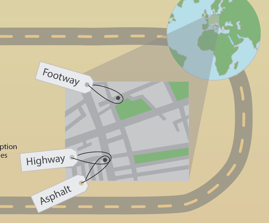
This thesis presents a method to automatically estimate road-surface types based on crowd-sourced and open source data to give cyclists an overview of the road conditions along a cycle route.Automatic classification of land-cover has been an active research field in recent years and mainly focuses on the classification of areas based on digital satellite and aerial imagery. Performing classification of road-surfaces based on such images bears some special challenges because roads have a width of only a few pixels on these photos, which makes it difficult to successfully apply classical image-analysis methods. Problems are caused by mixed pixels, which do not belong to a single surface class exclusively. Due to objects occluding the street, like for example trees and cars, it is difficult to isolate the street’s actual surface from the rest of the image. This biases the classification procedure and may cause faulty results. Furthermore, aerial images of high spatial resolution are only available with a small range of spectral bands.
This thesis proposes an alternative approach for road-surface classification by utilizing open source data with a focus on data from the project OpenStreetMap (OSM). OSM is an online mapping project which collects geographical data and makes it available freely by providing a digital world map. Data is collected by users on a voluntary basis. OSM offers its users the possibility to add various properties to streets by making textual annotations. From these so-called tags it is possible to deduce road-surface properties for numerous roads by using methods from pattern recognition. The system is designed so it can be extended with additional data from other sources (e.g., height information) to improve classification results. Classification takes place at two levels, based on a coarse-to-fine-grained surface taxonomy.
The method was evaluated on different testing areas in Austria and Liechtenstein. At the coarse-grained level, up to 90% of streets were correctly classified. At the fine-grained level, up to 60% of streets were correctly classified. The advantage of the proposed method is that it is fast and applicable to regions worldwide at low cost, as long as sufficient OSM data for a certain region is available.
Additional Files and Images


Weblinks
No further information available.BibTeX
@mastersthesis{PODARAS-2017-ACRS,
  title =      "Automated Classification of Road-Surface Types Based on
               Crowd-Sourced Data",
  author =     "Silvana Podaras",
  year =       "2017",
  abstract =   "This thesis presents a method to automatically estimate
               road-surface types based on crowd-sourced and open source
               data to give cyclists an overview of the road conditions
               along a cycle route.  Automatic classification of land-cover
               has been an active research field in recent years and mainly
               focuses on the classification of areas based on digital
               satellite and aerial imagery. Performing classification of
               road-surfaces based on such images bears some special
               challenges because roads have a width of only a few pixels
               on these photos, which makes it difficult to successfully
               apply classical image-analysis methods. Problems are caused
               by mixed pixels, which do not belong to a single surface
               class exclusively. Due to objects occluding the street, like
               for example trees and cars, it is difficult to isolate the
               street’s actual surface from the rest of the image. This
               biases the classification procedure and may cause faulty
               results. Furthermore, aerial images of high spatial
               resolution are only available with a small range of spectral
               bands.  This thesis proposes an alternative approach for
               road-surface classification by utilizing open source data
               with a focus on data from the project OpenStreetMap (OSM).
               OSM is an online mapping project which collects geographical
               data and makes it available freely by providing a digital
               world map. Data is collected by users on a voluntary basis.
               OSM offers its users the possibility to add various
               properties to streets by making textual annotations. From
               these so-called tags it is possible to deduce road-surface
               properties for numerous roads by using methods from pattern
               recognition. The system is designed so it can be extended
               with additional data from other sources (e.g., height
               information) to improve classification results.
               Classification takes place at two levels, based on a
               coarse-to-fine-grained surface taxonomy.  The method was
               evaluated on different testing areas in Austria and
               Liechtenstein. At the coarse-grained level, up to 90% of
               streets were correctly classified. At the fine-grained
               level, up to 60% of streets were correctly classified. The
               advantage of the proposed method is that it is fast and
               applicable to regions worldwide at low cost, as long as
               sufficient OSM data for a certain region is available.",
  month =      may,
  address =    "Favoritenstrasse 9-11/E193-02, A-1040 Vienna, Austria",
  school =     "Institute of Computer Graphics and Algorithms, Vienna
               University of Technology ",
  URL =        "https://www.cg.tuwien.ac.at/research/publications/2017/PODARAS-2017-ACRS/",
}