

 Poster
 Thesis
Information
- Publication Type: Master Thesis
- Workgroup(s)/Project(s):
- Date: March 2013
- Date (Start): 7. May 2012
- TU Wien Library:
- First Supervisor:
- Keywords: Landspotting

Abstract
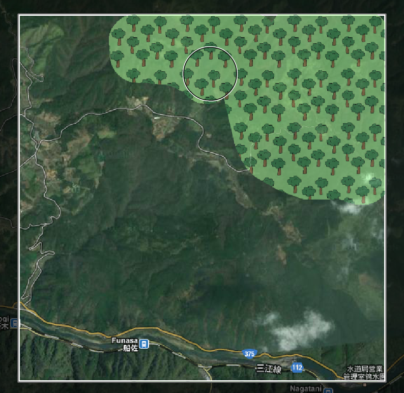
Remote sensing of land cover has, not at least because of the rapidly growing world population, gained scientific and economic importance. Several international projects have aimed to determine and map out the global land cover. Unfortunately the results of remote sensing projects such as GLC-2000, MODIS or GlobCover are often ambiguous or have significant differences.The project Geo-Wiki.org examines the results of that remote sensing projects and tries to validate them with the help of volunteers. This task requires a large amount of participants. Among other, competitions animate volunteers to contribute to the crowdsourcing project. To motivate volunteers to participate in the remote sensing of land cover is one of the key aspects within the Geo-Wiki.org project. One approach to reach new users for the project is to develop computer games that implement the classification of land cover areas as part of the game. The project Landspotting is a platform that aims to develop Serious Games for land cover classification. This thesis focuses on the development of a computer game for mobile devices that implements the classification of land cover as an integral part. Previous projects such as the game Landspotting for the platform Facebook are presented in the thesis. This games inspired the design process. Mobile devices with built-in, touch-sensitive displays offer the possibility to classify the land cover by painting appropriate sections of satellite images on the screen. The results of this categorizations are compared with data provided by the Geo-Wiki.org project. The result of this comparison is the basis for the achieved progress in the game.
The as a part of this thesis developed computer game Landspotting was published on the 4th of January 2013. The game was downloaded and installed from a lot of players. The huge amount of land cover data obtained by players illustrates the great potential in the combination of crowdsourcing systems and serious games. The comparison of the data obtained permits both, conclusions about the quality of the results of the developed computer game, as well as on the quality of the results of the Geo-Wiki.org project.
Additional Files and Images


Weblinks
No further information available.BibTeX
@mastersthesis{pangerl_2013_GPD,
  title =      "Games with a Purpose: Design and implementation of serious
               games to determine the global land cover",
  author =     "Dietmar Pangerl",
  year =       "2013",
  abstract =   "Remote sensing of land cover has, not at least because of
               the rapidly growing world population, gained scientific and
               economic importance. Several international projects have
               aimed to determine and map out the global land cover.
               Unfortunately the results of remote sensing projects such as
               GLC-2000, MODIS or GlobCover are often ambiguous or have
               significant differences.  The project Geo-Wiki.org examines
               the results of that remote sensing projects and tries to
               validate them with the help of volunteers. This task
               requires a large amount of participants. Among other,
               competitions animate volunteers to contribute to the
               crowdsourcing project. To motivate volunteers to participate
               in the remote sensing of land cover is one of the key
               aspects within the Geo-Wiki.org project. One approach to
               reach new users for the project is to develop computer games
               that implement the classification of land cover areas as
               part of the game. The project Landspotting is a platform
               that aims to develop Serious Games for land cover
               classification. This thesis focuses on the development of a
               computer game for mobile devices that implements the
               classification of land cover as an integral part. Previous
               projects such as the game Landspotting for the platform
               Facebook are presented in the thesis. This games inspired
               the design process. Mobile devices with built-in,
               touch-sensitive displays offer the possibility to classify
               the land cover by painting appropriate sections of satellite
               images on the screen. The results of this categorizations
               are compared with data provided by the Geo-Wiki.org project.
               The result of this comparison is the basis for the achieved
               progress in the game.  The as a part of this thesis
               developed computer game Landspotting was published on the
               4th of January 2013. The game was downloaded and installed
               from a lot of players. The huge amount of land cover data
               obtained by players illustrates the great potential in the
               combination of crowdsourcing systems and serious games. The
               comparison of the data obtained permits both, conclusions
               about the quality of the results of the developed computer
               game, as well as on the quality of the results of the
               Geo-Wiki.org project.",
  month =      mar,
  address =    "Favoritenstrasse 9-11/E193-02, A-1040 Vienna, Austria",
  school =     "Institute of Computer Graphics and Algorithms, Vienna
               University of Technology ",
  keywords =   "Landspotting",
  URL =        "https://www.cg.tuwien.ac.at/research/publications/2013/pangerl_2013_GPD/",
}