

At present there is no single satellite-derived global land cover product that is accurate enough to provide reliable estimates of forest or cropland area to determine, for example, how much additional land is available to grow biofuels or to tackle problems of food security. This project aims to improve the quality of this land cover information by vastly increasing the amount of in-situ validation data available for calibration and validation of satellite-derived land cover.
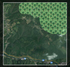
The Geo-Wiki (Geo-Wiki.org) system currently allows users to compare three satellite derived land cover products and validate them using Google Earth. However, there is presently no incentive for anyone to provide this data so the amount of validation through Geo-Wiki has so far been quite limited. The LandSpotting project will take a truly innovative approach by the addition of crowdsourcing through the development of a game. The game will engage users whilst simultaneously collecting a large amount of in-situ land cover information. The development of the game will be informed by the current raft of successful social gaming that is available on the internet and as mobile applications, many of which are geo-spatial in nature.
At the same time, the Geo-Wiki system will be modified to exploit the latest available satellite images and to use the acquired in-situ validation information to create new outputs: a hybrid land cover map, which takes the best information from each individual product to create a single integrated version; a database of validation points that will be freely available to the land cover user community; and a facility that allows users to create a specific targeted validation area, which will then be provided to the crowdsourcing community for validation. These outputs will turn Geo-Wiki into a valuable system for many users of land cover.
Funding
- FFG 2008999
Publications
4 Publications found:
Download list as Bibtex, HTML (Advanced, Expert), JSON (with referenced objects), CSV, Permalink
| Image | Bib Reference | Publication Type |
|---|---|---|
| 2013 | ||
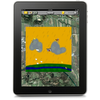 |
Tobias Sturn, Dietmar Pangerl, Linda See, Steffen Fritz, Michael Wimmer Landspotting: A Serious iPad Game for Improving Global Land Cover In Proceedings of the GI-Forum 2013 -- Creating the GISociety, pages 81-90. July 2013. [  Paper] [ Paper] [ |
Conference Paper |
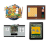 |
Tobias Sturn, Michael Wimmer, Peter Purgathofer, Steffen Fritz Landspotting - Games for Improving Global Land Cover In Proceedings of Foundations of Digital Games Conference 2013 (FDG 2013), pages 117-125. May 2013. [  Paper] Paper] |
Conference Paper |
 |
Dietmar Pangerl Games with a Purpose: Design and implementation of serious games to determine the global land cover [  Poster] [ Poster] [ Thesis] Thesis] |
Master Thesis |
| 2012 | ||
 |
Steffen Fritz, Peter Purgathofer, F. Kayali, M. Fellner, Michael Wimmer, Tobias Sturn, Josef Schuh, G. Triebnig, S. Krause, F. Schindler, M. Kollegger, C. Perger, M. Dürauer, W. Haberl, L. See, Ian McCallum Landspotting: Social gaming to collect vast amounts of data for satellite validation, 23. April 2012, 16:00, European Geosciences Union General Assembly 2012, Austria Center Vienna, Session ESSI2.9, room 7 [  abstract] abstract] |
WorkshopTalk |