Speaker: Johannes Eschner (193-02 Computer Graphics)
Current approaches to backcountry ski tour planning call for the user to integrate multiple information sources in order to judge the avalanche risk. We present a novel integrated real-time visualization which combines information from multiple data sources into a single interactive visualization. Furthermore, our visualization is based on a high-resolution digital elevation model, which allows for a detail-preserving terrain representation to facilitate navigation tasks.
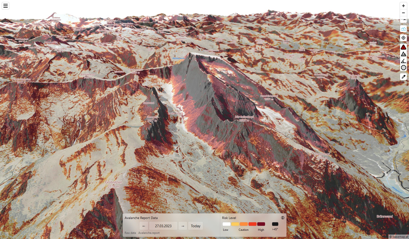
In this thesis we analyze the state of the art in avalanche risk visualization, in order to build a prototype implementation which combines terrain data with time-dependent data from the avalanche warning services. The avalanche risk evaluation is done using existing risk reduction methods, which we implement on the GPU. By having a real-time risk evaluation, we can visualize the avalanche risk for all of Austria in a browser-based 3D terrain renderer. In a qualitative user study, we let users with different levels of experience perform tour planning tasks using our system. Results of the study show that users do prefer the 3D visualization over traditional map representations, however they also show a preference for more customizable planning tools. While there are still open challenges in the visual blending of the risk overlay as well as in incorporating additional information provided by written avalanche reports, the prototype shows that a large-scale real-time avalanche risk visualization is feasible and can be a helpful tool to assist recreationists in planning backcountry ski tours.