3D Laser Scanning at the Leopoldsberg
The requirements of the project LEOPOLD for the three mixed reality installations, which were constructed within the project made it necessary to produce high quality survey data. Terrestrial laser scanning seemed the most efficient way to get a complete and real 3D geo-referenced model of the Leopoldsberg plus surrounding.
Terrestrial laser scanning is an efficient technology for the acquisition of high resolution 3D data on surfaces and the digital documentation of historical and archaeological sites. The latest 3D laser sensors from Riegl LMS proved to be effective rugged tools for the fast and high resolution scanning of historical buildings as well as archaeological surfaces on excavations. For this project we used a terrestrial 3D Laser Scanner RIEGL LMS Z420i. The used RIEGL LMS Z420i system consists of a high-performance long-range laser scanner with a wide field-of-view and a orientated calibrated high-resolution digital camera NIKON D100 firmly mounted to the scanning head of the laser scanner and provides scan and image data. The scanner measures the distance to the object by recording the time of flight of the laser signal with high precision.
This data can be automatically or semi-automatically processed to generate products such as colored point clouds, DTM´s, textured triangulated surfaces or orthophotos with depth information. The scanner used has a field-of-view of 360 x 80 degrees and collects data in a range of up to 800m with an angular resolution of down to 0.018 degrees. The primary result is thus a 3D point cloud of the scanned surface. Texturing 3D models generated from laser scan data with image data is well-established and many of the 3D data processing packages provide at least some means for texturing the surface of a 3D model. Integrating a high-resolution calibrated camera into a laser scanning system provides a very efficient, convenient, and powerful system for automatically generating accurately textured high-resolution 3D models.
Beside the project LEOPOLD the generated data will be used as a valuable source for further archaeological and historical research in the area on and around of the Leopoldsberg.
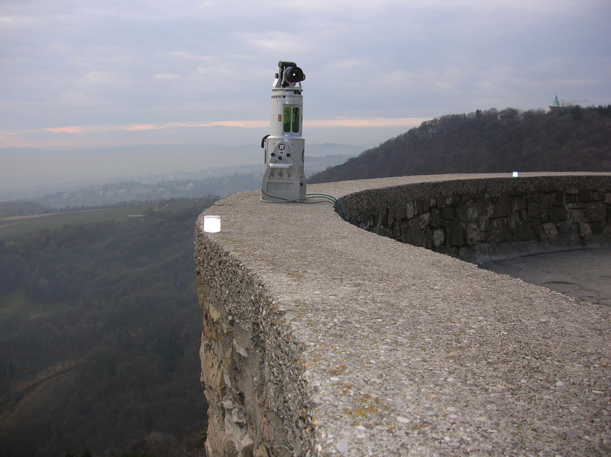
The Riegl Scanner in operation at the balustrade of the castle at Leopoldsberg.
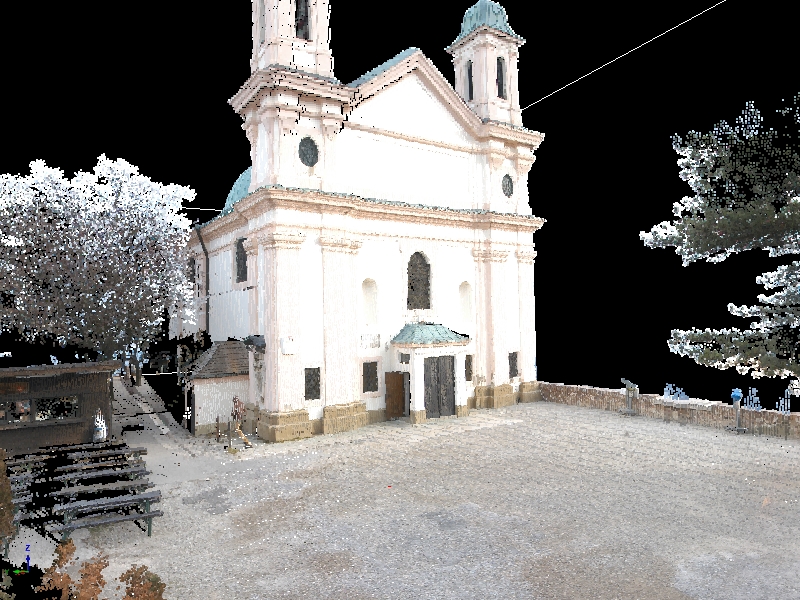
One scanning result showing the church at the Leopoldsberg as textured point cloud.